Here’s what Weiser River Trail Board Member, Ron Hundahl said about his experience with that trail project in Idaho:

“When we started planning the Weiser River Trail in 1998, there was opposition from some people that users would trespass on adjacent land, cattle would be harmed, and property vandalized. But it's been 25 years now and none of that has happened -- we've not had one instance of trail users vandalizing adjacent property or hurting livestock. Today, the children and grandchildren of some of those early opponents are now riding and using the trail. And realtors listing property tout the proximity to the trail as a selling point."


Trail Frequently Asked Questions
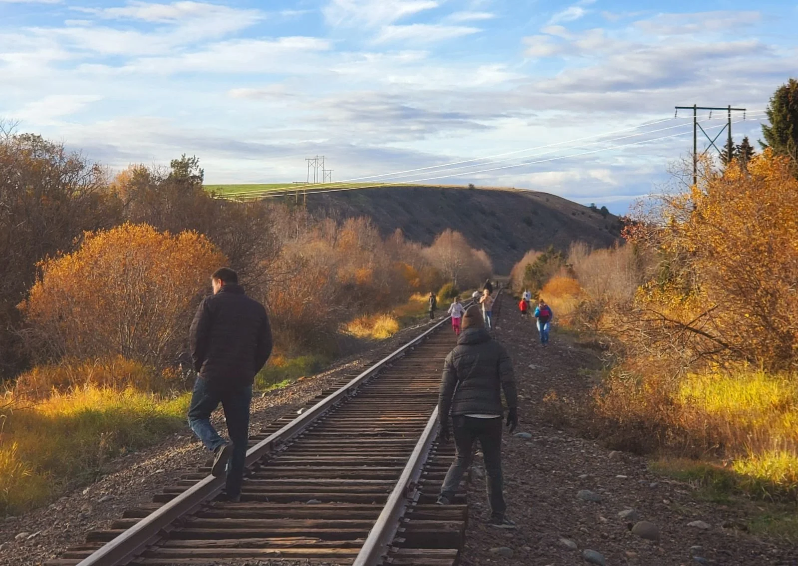
 

What is the Status of the Trail?

The Joseph Branch Trail Consortium is making great strides! In February 2021, the board of directors hired Gregg Kleiner as Project Coordinator to help manage the project, including greater community outreach, fundraising, and communication with membership. In October 2021, we were awarded two state grants totaling more than $333,000. The first grant, from Oregon State Parks, will construct the first trailhead/pocket park in Elgin in summer 2023, as well as the first section of ADA-compliant trail out of town along the Grande Ronde River. The second grant, from the Oregon Dept. of Transportation’s Transportation Growth Management (TGM) program is funding development of a refinement plan for a 16-mile section of the trail between Elgin and the border of Union and Wallowa county near Lookingglass. In October 2022, we were awarded another TGM grant from the Oregon Dept. of Transportation for approximately $175,000 to develop a detailed refinement plan for a 1-mile trail section and trailhead within the City of Wallowa, and for the 13 miles of trail between Wallowa and Minam. Other grants from the Schwemm Family Foundation, the Roundhouse Foundation, and Cycle Oregon are helping support trailhead development.

We have established great relationships with programs, professors, and students at Eastern Oregon University which helped us update our Concept Plan for the Elgin-end of the trail, and other projects. We are teaming with the City of Elgin and the City of Wallowa to establish a trailheads/parks and trail segments. Several other trailhead locations are being considered and access points are mapped. A link to the original, 2015 Concept Plan which shows a breakdown of the segments of the trail can be found here.

Who is the trail for?

The Joseph Branch Trail-With-Rail is being designed to be used by people of all ages and abilities. While Northeast Oregon is rich in natural beauty and outdoor recreational opportunities, many of the trails can be too rugged for some people to access. Our goal is for anyone to be able to lead a healthy lifestyle and provide a pathway for people to safely recreate, or commute away from busy highways and county roads.

Are trails with rails safe?

Since rail-trails started cropping up all over the U.S., there has been concern over the safety and liability of trails and their impacts on adjacent properties. Many of the most prominent concerns are that trails promote trespassing, litter, theft, and a reduction in property values. However, despite these concerns being regularly raised, trails have consistently been shown to have a positive effect on crime rates and property values throughout the country. Studies on individual trails like the Burke-Gilman trail in Seattle have shown crime rates to either be unaffected, or reduced by the regular use of trails. These findings are supported in broad trail studies and is consistent across both urban and rural areas. In 2015, a study of nine rail-trails through agricultural areas across the country found no increases in crime and farmers were quoted as not having had any issues with trespassing.

Ron Hundahl, a board member of the Weiser River Trail in Idaho said this in 2023:

“When we started planning the Weiser River Trail in 1998, there was opposition from some people that users would trespass on adjacent land, cattle would be harmed, and property vandalized. But it's been 25 years now and none of that has happened -- we've not had one instance of trail users vandalizing adjacent property or hurting livestock. Today, the children and grandchildren of some of those early opponents are now riding and using the trail. And realtors listing property tout the proximity to the trail as a selling point."

Who is liable in the event of trespassing?

The publicly owned, 100-foot-wide railroad corridor is operated by the Wallowa Union Railroad Authority, an ORS 190 intergovernmental agreement between Wallowa and Union counties. For adjacent landowners, there is justified concern over the liability of a trespasser being injured on private property next to the corridor. However, there are laws in place to protect private landowners from such an incident. As the manager of the trail, JBTC will further mitigate the risk of trespassing by placing notices along the trail and at trailheads to ensure users remain within the approximately 100-ft.-wide trail corridor and do not enter adjacent private properties.

The following passage is an excerpt from the Wallowa-Union Railroad Authority Management Plan prepared jointly with JBTC:

“Oregon’s trespassing definition and penalties are found in ORS Section 164 under the Burglary and Criminal Trespass section. Trespassing occurs when someone enters and remains unlawfully on a property or premise when they don’t have permission to do so. Trespassers are afforded scant legal protection. Generally, a landowner has no duty to maintain the land for the safety of trespassers. Trespassers can be found guilty of crimes of varying degrees based on the type of property and situation. Damages that can be recovered are defined. It is the intent of the WURA board of directors to monitor user counts and trespass reports made to public safety officers and the trail manager.”

Additionally, Oregon has laws protecting private landowners from liability from harm when the land is used for recreational purposes. A summary of the statutes is shown below:

ORS 105.682 explains that Oregon’s legislature’s policy is to encourage the use of private land for recreational purposes. To do this they have established policies to absolve landowners for liability for any personal injury, death or property damage that arises out of the use of land for recreational purposes. ORS 105.688 clarifies immunities provided in ORS Section 105.682 applies only if the landowner does not charge for permission to use the land or transfers an easement to a public body to use the land. Protection is lost if fees are charged for access to a property for recreation purposes. ORS 105.700 defines notice and their form that must be posted to deny right of way to private property and damages that may be recovered from persons who trespass.

What community outreach has been done?

From 2014-2016, a joint effort between the JBTC, Eastern Oregon University, Oregon State Parks, and the Northeast Oregon Economic Development District conducted a series of public outreach meetings and surveys to gauge community interest and support. A summary of that information can be found here. In 2021, the JBTC brought on a project coordinator to continue public outreach and relationship building with community members and adjacent landowners. Outreach continues, including a 2023 letter to adjacent landowners in Union County.

We hold various public events and meetings, and everyone is welcome to attend. People interested in supporting the project are encouraged to become members. For questions or concerns, reach out to the project coordinator via email at: info@josephbranchtrail.org.

How can i learn more?

To learn more and become involved in helping built the trail, send the Joseph Branch Trail Consortium a note via the form below. You can also contact us with questions or concerns; we are happy to discuss this project with anyone. If you’d like to support this work, consider becoming a member at any level HERE. It is the JBTC’s goal to help this project be a community asset for generations to come and work well for everyone by tapping the thoughtful and researched planning to date that has gone into this project for our community.

Will the tracks be removed for this project? And is the Wallowa Union Railroad Authority in support of this project?

No railroad tracks will be removed! The trail will be placed alongside, and a safe distance away from, the railroad tracks that run within the publicly owned 100-ft-wide railroad right-of-way that is managed by the Wallowa Union Railroad Authority (WURA), an intergovernmental agreement between Union and Wallowa counties. The Eagle Cap Excursion Train, operated by the Friends of the Joseph Branch, will proceed as normal, as will the Joseph Branch Railriders. WURA is in full support of the project and sees the trail as a bonus to the maintenance of the railroad bed, primarily to help with weed control, access to the tracks for repairs, and bridge improvements.

how wide will the trail be and who will be the users on it?

In and near towns, the trail will be a 8-ft.-wide, ADA-compliant path of compacted gravel base. Other parts of the trail will be more like a hiking trail. The trail will accommodate multiple users, including pedestrians, bicyclists, and horseback riders. In the winter, cross-country skiers, snow-shoers, and fat bikers will use the trail. JBTC has been studying best practices for multi-use pathways. This trail will have long sight distances with long straightaways along with “rules of the trail” signage that will help alleviate user conflict. And the JBTC will be ready to adapt management strategies should user conflicts arise. To see more about multi-use trail design with equestrians, visit this US Forest Service Trail Design Guide. Equestrians will be asked to remove manure from the trail and JBTC will be monitoring the trail with a utility vehicle and collecting manure on litter patrols on an as needed basis (for example, 2x a week during the summer and less frequently during lower use times). Trash receptacles will be placed at intervals along the trail, as well as doggie poop bags. These will also be checked on the JBTC Litter Patrol Route. Read more about management strategies below and here at the Joseph Branch Trail Management, Maintenance, and Signage Plan (in 3rd Draft Form).

From: USFS Publication “Designing horse trails”

From: USFS Publication “Designing horse trails

will the trail cross any private land besides WURA’s or will it be developed entirely in the railroad corridor?

The trail will be developed 100 percent within the publicly-owned, contiguous 100-ft.-wide WURA right-of-way next to the railroad tracks.

Who is wura and is this land available now for the public to access?

WURA (the Wallowa Union Railroad Authority) owns the 63-mile long railroad corridor, which is approximately 100 feet wide and runs between Joseph and Elgin, Oregon. WURA is an ORS-190.083 intergovernmental entity formed between Wallowa and Union Counties to co-own a transportation facility (the Wallowa Union Railroad). As of fall 2019, the railroad corridor is open to public use as WURA is protected by the Oregon Recreational Use Statute mentioned above. We just ask users to be respectful of adjacent landowners and be good stewards of the corridor.

Will Camping be allowed along the trail?

Absolutely not. This corridor is a transportation corridor and railroad right of way. Camping is illegal in the right of way, as outlined in our Management, Maintenance, and Signage Plan.

will campfires be allowed along the trail?

Again, absolutely not. Fire danger is serious and no exceptions will be made. Smoking is also not allowed along the trail, due to fire danger.

will e-Bikes be allowed?

No. Due to the non-motorized designation of the trail, e-bikes are not allowed. The trail will be used by hikers, walkers, horseback riders, and regular bicyclists. Motorized vehicles, like e-bikes, which can travel in excess of 30 mph, present a potential danger to horses and other users.

will this trail be funded by local tax dollars?

No. Local tax payer dollars will NOT be used in the construction and maintenance of this trail. State and federal tax dollars and lottery funds are allocated for trail development. Funds are also available from private foundations recognizing the importance of trails like this to the health of communities. Maintenance will be carried out by the Joseph Branch Trail Consortium (Board and Members), a Wallowa & Union County based non-profit, and community volunteers.

Is this trail for our community or for visitors?

This trail will be open to all active people, just like our county roads, sidewalks, and trails in the mountains. Around the U.S., trails like this are primarily used by members of the local communities they run through, providing a safe, accessible place for everyday exercise (see more benefits below). Research on the more than 23,000 miles of these kinds of trails in the U.S. show that 90 percent of the trail users are locals. That said, the trail will attract some visitors, which will offer an economic boost to some of the towns along the trail where visitors rarely stop as they drive toward the Wallowa Mountains.

what is a trail-With-Rail? Are there others in the United states & are they safe?

A Trail-WITH-Rail is a trail placed within the railroad right of way, alongside existing railroad tracks. It’s a win-win situation for all. The tracks are preserved for rail use while allowing non-motorized access to the railroad right of way. There are approximately 1,397 miles of Trail-With-Rails in the United States (as of 2013) and HERE IS A LIST of them. (A Rail-TO-Trail is when the tracks are removed and the trail is placed on the track bed. There are approximately 23,615 miles of Rails-to-Trails and Trails-With-Rails in the United States.)

Safety is maintained on these trails through design and maintenance. In Wallowa County, the Eagle Cap Excursion Train, cannot currently travel beyond Minam and up into the Wallowa valley due to the deteriorated conditions of the railroad bed. When the train is able to travel to Wallowa and farther, the slow speed of the train, about 10 mph max, will ensure trail users are not impacted by a high-speed train. The Joseph Railriders will continue using the tracks between Joseph and Enterprise.

family-trail-Tennessee.jpg

Who is spearheading this project? Is it a group from within our community or an outside entity?

This trail is a grassroots movement within Wallowa & Union Counties. The Joseph Branch Trail Consortium (JBTC), a 501c3 non-profit based in Wallowa & Union Counties, is working closely with the Wallowa Union Railroad Authority (WURA) to develop, build, and maintain this trail for OUR COMMUNITIES. Local residents on the JBTC Board and board advisors include: medical doctors and nurses, university professors, a rancher, an attorney, a plumber, an Air Force veteran, business owners, and non-profit professionals. This trail is being developed BY our communities FOR our communities. Without a Parks & Recreation District/Department in Wallowa County, recreation projects like this come from the private sector. Visit our Polling Data to learn about the general community support for the project in Wallowa and Union Counties.

Who is involved in the planning of this project?

The Joseph Branch Trail Consortium (JBTC), in partnership with the Wallowa Union Railroad Authority (WURA), is leading the planning and development of the trail. The Concept Study for the trail was produced by Eastern Oregon University (EOU) and Oregon State Parks (OSP), with aid from WURA and JBTC. For the Concept Study, EOU and OSP conducted a public survey and held initial public collaborative planning meetings to better understand the desires and concerns of the community. JBTC has hosted public meetings, walking tours, and other events for the purposes of informing the public and taking public input. Anderson Perry, an engineering firm in La Grande, OR, designed the Pre-Engineering Study with the JBTC. Anderson Perry has also prepared the Cultural Resources Inventory and Wetlands Delineation Study. 

What is the zoning of the right of way?

The approximately 100-ft.-wide railroad right-of-way, is zoned according to the zoning of the properties it passes through. So, from the center of the tracks to the left, for example, if the adjacent property is zoned industrial, that 50’ portion of the tracks is zoned industrial. The right of way passes through many zones as it travels through the counties. From Joseph to Enterprise, the zones range from EFU (Exclusive Farm Use) to Industrial to Rural Residential.

Traditionally, railroad right of ways in Oregon are zoned as Transportation Corridors, as that is what they are. However, in Wallowa County, this is not the case. In Union County, the railroad right of way is zoned as a Transportation Corridor. The trail is still a conditional use in a Transportation Corridor, but the criteria it needs to meet are much less diverse.

What is a conditional use permit and why does the trail need this permit?

In ‘Planning Speak’, there are outright, or allowed uses on land and then there are conditional uses. Conditional uses are uses that can be approved, but may have conditions placed on them. For example, to protect people’s privacy along the trail, a vegetation barrier or fence could be a condition required to protect their privacy.

The trail is a conditional use in the zones it travels through. Therefore, JBTC needs to obtain this permit to develop the trail. The most frequent zone the railroad right of way passes along is EFU. View the Conditional Use Permit Application: Part 1 & Part 2.

Why Place a Multi-use Trail next to the Railroad Tracks?

The idea for a trail spawned from the informal use already occurring in the corridor (which is illegal activity). This illegal informal use has provided a sort of testing ground and it has not resulted in any known issues with privacy or litter. In fact, from interviews with adjacent landowners, the planners have learned areas and issues that need to be addressed by a managed trail (like dogs).

The railroad corridor follows the Wallowa River as it meanders through our valley, connecting the towns of Joseph, Enterprise, Lostine, and Wallowa. Currently, the tracks in the Wallowa Valley are not able to support a train as some bridges need repair. Funds for these repairs are not available, but the trail development plan ideally provides funds for bridge improvement for pedestrians and the train. Wallowa County is in need of providing safe alternatives for cyclists to commute between Enterprise and Joseph, and beyond to Elgin one day. Oregon Department of Transportation is very interested in this project as they seek to get more cyclists off of Highway 82. In this era of distracted drivers with cell phones and increased RV/general visitor traffic to the county each summer (over 800,000 visitors in 2017 alone (Source: Wallowa County Chamber of Commerce)), it is our community's responsibility to seek out existing infrastructure to provide safe alternative pathways for walking, biking, and horseback riding between our towns.

What will be different about this trail since we already have so many in the mountains?

This trail will be the first of its kind in Wallowa and Union counties. It will be very close to and central to our communities, linking residents and offering accessible, outdoor exercise. The trail will be very relatively flat, allowing access for a range of ages and abilities: families, elders, cyclists, runners, school sports teams, parents with strollers, people who use wheelchairs, bike commuters, and others. It will also provide a nature experience (no cars) close to our towns. Research shows that nature trails closer to "urban" centers are used more frequently by locals than trails where longer travel to trailheads is required.

What benefits will a trail like this bring to our communities?

There are more than 23,000 miles of trails similar to this in the U.S., traversing rural and urban communities. Benefits to community members include:

  • A nature experience close to our urban centers, free of cars, and easy for all in our community to access,

  • Increased opportunity for physical fitness in a safe environment (e.g., bicycling free of cars),

  • Safe commuting routes between towns (via bicycle, horseback, hiking, and cross-country skiing),

  • Increased opportunity for one-on-one interactions, fostering greater community engagement,

  • Increased opportunities for community events (e.g., community fundraisers, including walkathons, runs, & bike rides),

  • An opportunity to educate visitors through interpretive signs about our community's natural and cultural history, including land stewardship (from Nez Perce to Ranching Heritage), and

  • Walking/jogging trails are one of the top 3 considerations for all age brackets, especially families, looking to relocate (The National Association of Homebuilders (2016)).

  • There will be more benefits we're sure that will be realized once the trail is constructed.

Is hunting currently allowed in or across the Railroad right of way?

No, hunting is not allowed in or across the railroad right of way. Please refer to Oregon Big Game Hunting Regulations website: http://www.eregulations.com/oregon/big-game-hunting/general-hunting-regulations/. The Oregon Big Game Hunting Regulations state:

It is unlawful to:

  • Hunt or shoot from or across a public road, road right-of-way or railroad right-of-way, except persons legally hunting on roads closed to use of motor vehicles by the public.

Will this trail benefit the countIES with its short and long term community planning?

Yes, the trail will help Wallowa County meet the following Planning Goals:

  • County Comprehensive Plan:

    • Goal 8: Recreation Needs: To satisfy the recreational needs of visitors and of citizens of the County, and State, to promote recreation as an industry, and to improve or mitigate watershed conditions through well planned development in Wallowa County.

      • General Finding 11: It is vital to County recreation and tourism industries that access to recreation and tourism areas be maintained. Access includes not only roads, but trails, cat roads, access easements, and other means of access.

  • Wallowa County Transportation Plan (2001):

    • Goal 4: Increase the use of alternative modes of transportation (walking, bicycling, and public transportation) through improved access, safety, and service is of particular interest to us.

    • Goal 6: Although the County is no longer served by a branch railroad line, the County recognizes the railroad line and its right of way as an asset to be put to the highest and best use for the entire County.

  • Oregon State Planning Goal 12: Transportation:

    • (b) Encourage and support the availability of a variety of transportation choices for moving people that balance vehicular use with other transportation modes, including walking, bicycling and transit in order to avoid principal reliance upon any one mode of transportation;

    • (c) Provide for safe and convenient vehicular, transit, pedestrian, and bicycle access and circulation;

How wide is the railroad corridor? is it fenced?

The corridor is 100 feet wide in most places and is fenced on both sides in many places. The fence will remain when the trail is constructed. The current fence will be replaced by JBTC with woven wire fencing where dogs on the trail and livestock need to be separated.

Who will be the trail users?

Non-motorized trail traffic, just like the people we see using our county roads already: hikers, bikers, and horseback riders. There is informal trail use already happening in the railroad right of way. Once the trail is built, the majority of users will be from Wallowa County and folks of all ages and abilities. This project will help make the non-motorized, multi-use access legal for Wallowa Union Railroad Authority (WURA) in the right of way. And the project will open up the trail to participants representing a spectrum of ages and physical abilities. Research shows that trails closer to "urban" centers are used more frequently by locals than trails where longer travel to trailheads is required.

And recreational trail users on the many miles of trails like these all over the United States have shown time and again to be good citizens, interested in nature and physical health. Good people and good, proven trail design push out unwanted activity.

Will there be an increase in trespass, littering, vandalism, and other illegal activities?

Good trail design and public activity on the trail will push out bad intentions. Bad things generally occur where people do not frequent. The JBTC has no reason to conclude that trespassing by persons walking, riding bikes or horses along a trail in the corridor will be more frequent or consequential than potential trespass by persons using public roads already established throughout the counties. The vast majority of trails in the United States have experienced a decrease in unwanted activities such as those listed above (see Rails-Trail and Safe Communities). The reason is that people tend to perform illegal activities in places where there are no reputable citizens frequenting the area. On trail after trail, people have seen the rail corridor transformed from a place that is unkempt and containing litter to one that becomes an amenity for the area that showcases its natural beauty and heritage. Fencing and/or visual screening will be used where trespassing onto private property is of a particular concern. The trail will be managed by the Joseph Branch Trail Consortium and be subject to the rules and regulations approved by the Wallowa Union Railroad Authority. For an extensive study of rail-trails in the United States, visit Rails-Trail and Safe Communities.

Are there concerns from adjacent landowners about the trail and how will they be addressed?

The JBTC has gathered adjacent landowner concerns through multiple public meetings and private interviews (including site visits). These concerns have been heard and mitigation strategies discussed in the Draft Management Plan. Adjacent landowners have been asked for feedback on the management plan and responses were integrated into the plan, now in 3rd draft form. Relations with adjacent landowners are ongoing. The corridor is currently open to users, but is unmanaged use. During volunteer cleanup days in 2017 & 2018 in the Joseph to Enterprise corridor, the primary litter was broken glass from beer bottles. More users on the trail and management of hours will help reduce delinquent activity in the corridor and provide more protection for many of the adjacent landowner concerns than the current situation.

This trail will be the same as users walking on our roads or sidewalks. There will be a 30 foot easement from the trail to the fence next to adjacent lands. In fact, this trail will parallel county roads in many places, but provides a safe distance from cars on these roads. Concerns like trespass, littering, weeds, and dogs are traditionally raised all over the United States when community trails are proposed. These valid concerns time and again are proven to not come true to the extent initially thought by adjacent landowners. On the contrary, many adjacent landowners have become strong advocates for the trails once they are constructed (Source: Corning S., Mowatt R., and Chancellor C. (2012). Multiuse Trails: Benefits and Concerns of Residents and Property Owners. Journal of Urban Planning and Development. No. 138: 277-285).

Jogger on Ski Run Road in Joseph, a common scene

While the trail will be within the publicly owned, continuous WURA right of way, it will not cross any private land. The trail will be solely within the WURA right of way with a border fence. In addition, adjacent landowners have a variety of Oregon laws in place to protect them, from the Right to Farm Law, trespassing laws, and Oregon’s Recreational Use Statute. For a synthesis of legal concerns, visit the Headwater Economics study of Legal Issues Associated with Trails.

Will the police respond to calls on it?

Yes, the County Sheriff’s Departments will respond to calls on this trail just like anywhere else in Wallowa or Union counties. And much of the trail is visible from county roads.

What are some of the Trail Design Ideas that will help adjacent landowners with some of their concerns?

Each of the concerns raised have solutions and JBTC has been and will continue to work with willing adjacent landowners to implement the best solutions for all. The primary issues are trespassing, littering, loss of privacy, weeds, and dogs. Here are design ideas being considered for the trail for each issue:

  • Fencing: The 100-foot-wide railroad corridor is already fenced on both sides in many places. Where sensitive livestock issues exist, a woven wire fence will be placed to keep dogs separate from livestock.

  • Dogs: Dogs will be leashed (leash rule on trail). Trail users will be notified of this rule by signs at each access point. Woven wire fencing will be placed by the JBTC in areas where sensitive livestock issues exist. Trail users will also be notified that landowners have the right to shoot at dogs found trespassing and bothering livestock. Dog owners will also be asked to pick up dog feces. Doggie bag dispensers will be placed at each access point, as well as trash cans.

  • Littering: Recreational trail users have been shown to generally be good citizens, packing out their litter. Trash cans will be placed at access points and along the trail, too. For those leaving litter behind, the Joseph Branch Trail Consortium (JBTC) will have a routine cleanup route on the trail. Additionally, local groups will be encourages to adopt trail segments and help with annual cleanup efforts.

  • Trespassing: The trail design between Joseph and Enterprise will have 2 major trailheads for access, as well as access points where some county roads cross the trail. Since there will be multiple access points for trail users, the trail design will reduce if not eliminate the need for trail users to cross private land to access the trail. The trail will be fenced on both sides, discouraging trail users from entering private land. Studies of other rural trail systems have shown that trail users are generally very respectful of private land, again like sidewalks and walking on roads. https://safety.fhwa.dot.gov/ped_bike/docs/rt_safecomm.pdf

  • Loss of Privacy: Some adjacent landowners were not bargaining for a trail near their property when they purchased it. The JBTC understands this change and will place vegetation barriers (fast growing bushes) and privacy fences where needed. And since 2014, there have been over 23,000 railriders in the corridor between Joseph and Enterprise daily for 7 months of the year without a complaint or incident. While this change is something to get used to for some, studies have shown that many adjacent landowners tend to see the trail as a benefit (health-wise, socially, and property value) once it is constructed (Source: Corning S., Mowatt R., and Chancellor C. (2012). Multiuse Trails: Benefits and Concerns of Residents and Property Owners. Journal of Urban Planning and Development. No. 138: 277-285). And trail recreation users have been shown to generally be respectful citizens and respect privacy of adjacent landowners. Additionally, benches and "social gathering areas" like trailheads will be located away from property owners concerned about privacy.

  • Weeds: Weeds are a concern already in the corridor and WURA currently contracts with the Wallowa County Weed Control Department to help control the weeds. The Joseph Branch Railriders also help with weed control. JBTC has been and will continue to organize volunteer clean up days where weeds are pulled and removed from the corridor. Timing of these clean ups will happen before key weed species are blooming to maximize impact of removal. Additionally, there will be Adopt-A-Trail segments where local businesses, organizations, and schools will be organized by JBTC to help control weeds and litter along the trail. Additionally, education interpretive signs will be placed along to trail to educate trail users unfamiliar with weeds and their impact on native plants, ranching, and livestock..

What benefit will the neighbors have from this trail?

Benefits will include:

  • Better water passage in ditches as culverts will be replaced (14 in the Joseph to Enterprise segment)

  • Better weed management within the Railroad Right of Way

  • “Policing” of the right of way. The current, informal use of the right of way has resulted in ‘dogs chasing livestock’ stories from adjacent landowners. The trail construction will include replacement of fencing (at JBTC’s expense) to woven-wire fencing where dog-livestock interactions have been proven to occur.

  • Litter patrol. Currently there is no littler patrol, except for JBTC’s volunteer clean up days. The current informal use has not resulted in much litter (as JBTC has found during these right of way cleanup days). Trash cans, dog waste bags, and bathrooms will be placed intermittently along the trail in some places. Bathrooms will be located at the trailheads and during higher use times in the summer, porta-potties might be strategically placed at other spots along the trail. Litter patrol will happen weekly during the summer and monthly during the lower volume use of the trail.

  • Overall Better Management of the right of way.

  • Long-Term: No effect on property values or an increase in property values, as proven by research of other trails in the United States:

do neighbors of other rail trails ever see benefit in having them nearby?

Through published research, personal anecdotes, and discussion with trail managers of other rail trails, we have found the following about neighbors and trails:

  1. Some adjacent landowners nationwide have had pre-construction concerns similar to those expressed in Union and Wallowa counties (crime, vandalism, trespass, illegal hunting, loss of property value, loss of privacy, and littering). Yet, after the trails are constructed, if the trail is designed correctly and management is performed as it should be, these concerns are not realized and trail use has either little or no effect for the neighbors, as shown in the research below:

    1. Rail-Trails and Community Sentiment: A Study of Opposition to Rail-Trails and Strategies for Success

    2. Evaluation of the Burke-Gilman Trail’s Effect on Property Values and Crime

    3. Indiana Trails Study: A Study of Trails in 6 Indiana Cities

    4. 2017 Indiana Trails Study: Measuring the Health, Economic, and Community Impacts of Trails in Indiana

    5. Multi-use Trails: Benefits and Concerns of Residents and Property Owners

  2. Below is a letter the JBTC received from an adjacent landowner to a trail in North Caroline and his experience before and after it was built:

John Musselwhite_Joseph Branch Trail copy.jpg


Where will the Trailheads be located?

In Elgin, the trailhead will be located across the street from the Elgin Train Depot on a parcel of city-owned land. In Wallowa, the trailhead will be near the downtown and likely sited on a parcel of land owned by the Wallowa Nez Perce Homeland Project. In Enterprise, a trailhead will be located at Marr Pond, in partnership with Oregon Department of Fish & Wildlife (ODFW). ODFW has expanded the trailhead area with an ADA-accessible bathroom, a large turn-around space, an ADA-compliant path near the pond, and more parking. In Joseph, a trailhead will likely be sited on the edge of town.

who will manage and maintain the trail?

The publicly owned Wallowa Union Railroad Authority (WURA), an ORS 190 intergovernmental agreement between Union and Wallowa counties, manages the railroad corridor. WURA manages the overall corridor, and the Joseph Branch Trail Consortium (JBTC) will manage and maintain the trail for WURA, similar to the Friends of the Joseph Branch for the Eagle Cap Excursion Train. Read about the community cleanups in the corridor organized by the Joseph Branch Trail Consortium in June of 2017 & again in 2018: Volunteer Clean Up. Part of the trail construction will include culvert replacements (14 alone in the Joseph to Enterprise segment) and bridge upgrades where possible. These upgrades will help ditch water flow to neighbors and fish and other wildlife passage.

How will the trail be maintained?

Like many other rail with/to trails across the United States that are not owned by a state park or maintained by a county entity, this trail will be maintained by a local 501c3 non-profit volunteer group (JBTC). The JBTC is a membership based organization and will seek funds through membership and grants, as well as set up an endowment. Local partnerships have been developed as well to help maintain trailheads. The Enterprise trailhead will be a partnership with the Oregon Department of Fish and Wildlife (ODFW) at the Marr Pond Wildlife Area. ODFW already has the funds to upgrade that trailhead location. The Joseph trailhead location will be a partnership with the Joseph Branch Railriders. The Weiser River Trail, an 83 mile long rail to trail in Idaho in existence for 21 years, has been managed by the Friends of the Weiser River Trail and mirrors the model the JBTC will be using. See a couple questions above for specific management strategies.

For more information about the management and maintenance of the trail, please visit the Management, Maintenance, and Signage Plan (3rd Draft)

How long has the Joseph Branch Trail Consortium been working on this project?

A trail along the tracks has been a dream of many for years. In 2013, the group that would become the Joseph Branch Trail Consortium (JBTC) started working with the Wallowa Union Railroad Authority (WURA) and Oregon State Parks to explore the development of the trail. In 2015, Eastern Oregon University and Oregon State Parks, along with WURA and JBTC, performed a Concept Study to determine if the trail was a viable option for Wallowa and Union Counties. Public surveys were taken, as well as cultural, environmental, and engineering studies. The Concept Study demonstrated public support, as well as viable engineering methods for the trail. In 2016, WURA approved the Concept Study and agreed to move ahead with the JBTC taking the lead on trail development. Currently, the JBTC is working with WURA on land use permitting.

What polling data has been collected for this project? And what kind of support does it show?

Three independent surveys have been performed in Wallowa and Union Counties (1 solely in Wallowa County) by Eastern Oregon University (2 polls) and the Wallowa County Chamber of Commerce (1 poll). In summary, a substantial majority of respondents to three surveys directed to different groups support the development of the trail from Elgin to Joseph, or to trail segments. There appears to be a broad and consistent positive opinion regarding the proposed Joseph Branch Community Trail by the majority of respondents. 

Results of 1 of 3 surveys performed in Wallowa & Union Counties in Oregon to determine support for the Joseph Branch Rail with Trail.

Results of 1 of 3 surveys performed in Wallowa & Union Counties in Oregon to determine support for the Joseph Branch Rail with Trail.